



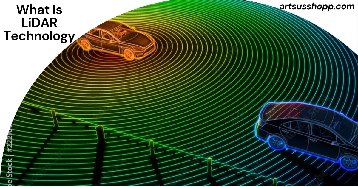
What Is LiDAR Technology? A Complete Beginner’s Guide to How LiDAR Works, Uses, Benefits, and Future Trends
If you have heard about self-driving cars, smart maps, drones, or advanced 3D scanning, you have probably come across the term “LiDAR.” Many people ask, “what is lidar technology” because it is becoming one of the most important technologies in the modern world.
LiDAR is changing industries such as transportation, construction, agriculture, defense, robotics, environmental science, and city planning. From helping autonomous vehicles avoid accidents to creating highly detailed maps of forests and roads, LiDAR is now part of many systems we use every day.
But what exactly is LiDAR? How does it work? Why is it important? And why are major companies investing billions of dollars into LiDAR research and development?
This complete guide explains everything in very easy English. You will learn what is lidar technology and how does it work, what is lidar technology in cars, what is lidar technology used for, and what is lidar sensor technology. You will also discover the advantages, disadvantages, future trends, and real-world applications of LiDAR technology.
By the end of this article, you will fully understand why LiDAR is considered one of the most powerful sensing technologies of the future.
What Is LiDAR Technology?
LiDAR stands for Light Detection and Ranging.
It is a remote sensing technology that uses laser light to measure distances and create detailed 3D images of objects and environments.
The basic idea is simple:
- A LiDAR system sends out laser pulses.
- The laser hits an object.
- The light reflects back to the sensor.
- The system measures how long the light took to return.
- A computer calculates the exact distance.
Because light travels extremely fast, LiDAR can make very accurate measurements in real time.
LiDAR systems can scan thousands or even millions of points every second. These points create a highly detailed 3D map called a “point cloud.”
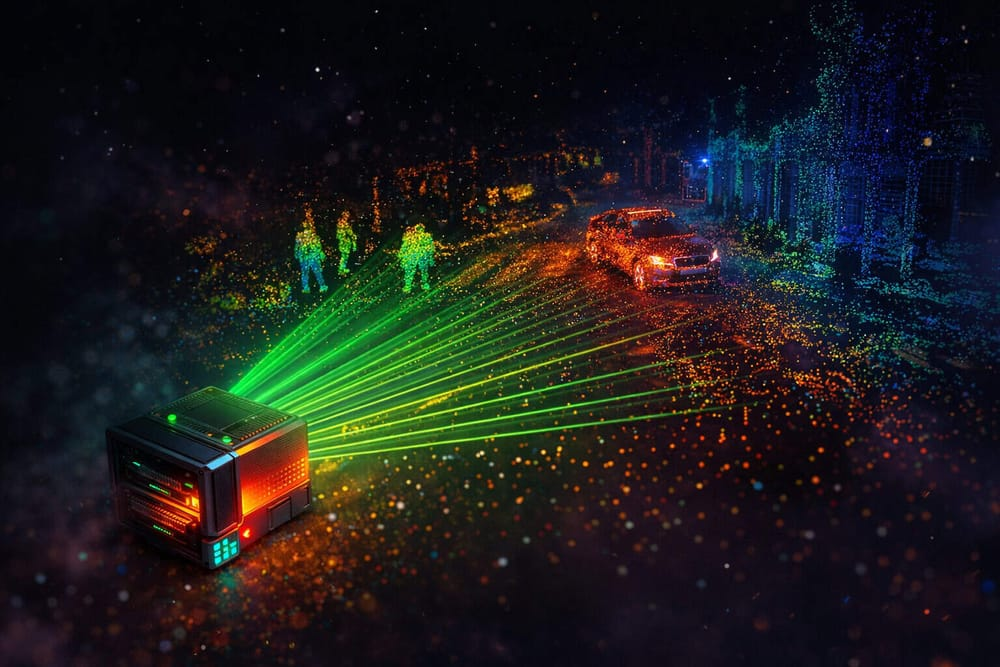
This technology allows machines to “see” the world around them with incredible precision.
What Is LiDAR Technology and How Does It Work?
To better understand what is lidar technology and how does it work, let’s break the process into simple steps.
Step 1: Emitting Laser Pulses
A LiDAR sensor sends out short pulses of laser light toward nearby objects.
These laser pulses move at the speed of light.
Step 2: Reflection From Objects
When the laser pulse hits an object such as a car, tree, building, or road, the light reflects back toward the sensor.
Step 3: Measuring Time
The LiDAR system measures the time it takes for the light to return.
Even tiny differences in time can show very accurate distances.
Step 4: Calculating Distance
The system uses a formula based on the speed of light to calculate the distance.
d=ct2d=\frac{ct}{2}d=2ct
In this formula:
- d = distance
- c = speed of light
- t = travel time of the laser pulse
Step 5: Creating a 3D Map
After millions of measurements, the system creates a complete 3D digital model of the environment.
This model helps machines understand shapes, distances, movement, and obstacles.
History of LiDAR Technology
LiDAR technology has been around for decades.
Early Development
Scientists first developed LiDAR in the 1960s shortly after lasers were invented.
Early systems were large, expensive, and mostly used for scientific research.
Growth in Aerospace
In the 1970s and 1980s, NASA and military organizations used LiDAR for mapping and atmospheric studies.
LiDAR became useful for:
- Measuring land elevation
- Studying clouds
- Monitoring forests
- Mapping oceans
Modern LiDAR Revolution
Today, LiDAR systems are smaller, faster, cheaper, and more powerful.
Modern advancements in:
- Artificial intelligence
- robotics
- autonomous driving
- drones
- semiconductors
have made LiDAR one of the fastest-growing technologies in the world.
What Is LiDAR Sensor Technology?
Many people also search for “what is lidar sensor technology.”
A LiDAR sensor is the device that sends and receives laser pulses.
The sensor collects data about the surrounding environment and converts it into digital information.
Main Components of a LiDAR Sensor
A LiDAR sensor usually includes:
Laser
The laser produces light pulses.
Scanner
The scanner moves the laser in different directions to cover a wide area.
Receiver
The receiver detects reflected light.
GPS System
GPS helps identify the exact location of the sensor.
Computer Processor
The processor converts raw data into maps and 3D models.
Also Read: What Is Known as BT in Genetic Technology? A Complete Beginner-Friendly Guide
Types of LiDAR Technology
There are several types of LiDAR systems.
Each type is designed for specific applications.
Airborne LiDAR
Airborne LiDAR is mounted on airplanes or helicopters.
It is mainly used for mapping large areas.
Applications include:
- Forest mapping
- flood analysis
- topographic surveys
- environmental monitoring
Terrestrial LiDAR
Terrestrial LiDAR is placed on the ground.
It scans buildings, roads, bridges, and construction sites.
This type is popular in engineering and architecture.
Mobile LiDAR
Mobile LiDAR is attached to moving vehicles.
It collects road and street data while driving.
This is widely used for:
- Autonomous vehicles
- smart city planning
- road inspections
Drone LiDAR
Drone-based LiDAR systems are becoming very popular.
Drones can easily access difficult locations.
Drone LiDAR is useful for:
- Mining
- agriculture
- land surveys
- disaster management
Solid-State LiDAR
Solid-state LiDAR has fewer moving parts.
It is smaller, cheaper, and more reliable.
This technology is expected to dominate future autonomous vehicles.
What Is LiDAR Technology Used For?
One of the most common questions is: what is lidar technology used for?
LiDAR has many real-world uses across different industries.
LiDAR in Self-Driving Cars
The automotive industry is one of the biggest users of LiDAR technology.
Self-driving cars use LiDAR sensors to:
- Detect obstacles
- identify pedestrians
- recognize traffic signs
- measure road distances
- avoid collisions
LiDAR helps vehicles understand their surroundings in real time.
What Is LiDAR Technology in Cars?
When discussing what is lidar technology in cars, the answer is simple:
LiDAR acts like the “eyes” of autonomous vehicles.
The sensor continuously scans the road and creates a 3D map of nearby objects.
This helps the car make safe driving decisions.
Why LiDAR Is Important in Cars
LiDAR provides several advantages for vehicles:
- Very accurate distance measurement
- Works day and night
- Fast obstacle detection
- Better depth perception
- Improved driving safety
Major automotive companies and technology firms continue investing heavily in LiDAR systems.
LiDAR in Mapping and Surveying
LiDAR is widely used to create accurate maps.
Traditional mapping methods take longer and require more labor.
LiDAR can quickly scan large areas with excellent precision.
Surveyors use LiDAR for:
- Elevation mapping
- land measurement
- road planning
- urban development
LiDAR in Agriculture
Farmers use LiDAR to improve crop management.
LiDAR helps analyze:
- Soil conditions
- crop height
- irrigation needs
- field patterns
This improves farming efficiency and reduces waste.
LiDAR in Forestry
LiDAR can measure forest density and tree height.
Environmental scientists use it to monitor:
- Deforestation
- wildlife habitats
- forest health
- carbon storage
LiDAR in Construction
Construction companies use LiDAR to create accurate 3D models of buildings and sites.
Benefits include:
- Better planning
- fewer mistakes
- improved safety
- faster project completion
LiDAR in Archaeology
LiDAR has transformed archaeology.
Researchers can discover ancient ruins hidden under forests and vegetation.
LiDAR has helped uncover lost cities and historical structures around the world.
LiDAR in Disaster Management
LiDAR helps governments prepare for natural disasters.
It is used for:
- Flood prediction
- earthquake analysis
- landslide monitoring
- coastal erosion studies
LiDAR in Robotics
Robots use LiDAR for navigation and obstacle detection.
Warehouse robots, delivery robots, and industrial machines rely on LiDAR to move safely.
LiDAR in Smart Cities
Smart cities use LiDAR to improve infrastructure and transportation systems.
Applications include:
- Traffic monitoring
- pedestrian analysis
- road safety
- urban planning
Advantages of LiDAR Technology
LiDAR offers many powerful benefits.
Extremely Accurate Measurements
LiDAR can measure distances with very high precision.
This makes it ideal for critical applications.
Fast Data Collection
LiDAR can collect millions of data points every second.
This allows rapid scanning of large areas.
Works in Darkness
Unlike traditional cameras, LiDAR works well at night.
Laser light does not depend on sunlight.
High-Resolution 3D Mapping
LiDAR creates detailed 3D models with excellent depth information.
Automation Support
LiDAR supports automation systems such as:
- Autonomous vehicles
- robotics
- drones
Better Environmental Analysis
Scientists use LiDAR for detailed environmental studies and climate research.
Disadvantages of LiDAR Technology
Although LiDAR is powerful, it also has limitations.
High Cost
Advanced LiDAR systems can be expensive.
This is one reason why some industries adopt the technology slowly.
Weather Challenges
Heavy rain, fog, or snow can reduce LiDAR performance.
Water particles may interfere with laser signals.
Large Data Processing Requirements
LiDAR creates huge amounts of data.
Powerful computers are needed to process and store this information.
Limited Object Recognition
LiDAR measures shapes and distances well, but cameras are sometimes better for identifying colors and text.
That is why many systems combine LiDAR with cameras and radar.
LiDAR vs Radar
People often compare LiDAR and radar.
Both technologies detect objects and measure distance, but they work differently.
ALso Read: How to Improve Crop Yield With Technology: The Complete Guide for Modern Farming
How Radar Works
Radar uses radio waves.
How LiDAR Works
LiDAR uses laser light.
Main Differences
Accuracy
LiDAR usually provides more detailed 3D images.
Range
Radar often works better over very long distances.
Weather Performance
Radar performs better in bad weather conditions.
Cost
Radar is generally cheaper than LiDAR.
Modern autonomous systems often combine both technologies for maximum safety.
LiDAR vs Cameras
Cameras capture images and colors.
LiDAR measures depth and distance.
Cameras Are Better For
- Reading signs
- recognizing colors
- identifying objects visually
LiDAR Is Better For
- Depth measurement
- 3D mapping
- accurate distance detection
Combining cameras and LiDAR creates more reliable systems.
How Accurate Is LiDAR Technology?
LiDAR is extremely accurate.
Some advanced systems can measure distances within a few centimeters or even millimeters.
Accuracy depends on factors such as:
- Sensor quality
- weather conditions
- scanning range
- processing software
Because of this precision, LiDAR is trusted in industries where accuracy is critical.
How LiDAR Creates 3D Maps
LiDAR produces something called a point cloud.
A point cloud contains millions of points in 3D space.
Each point represents a location where the laser hit an object.
Special software combines these points into:
- 3D models
- terrain maps
- digital twins
- virtual environments
This technology is important for simulation, gaming, architecture, and autonomous navigation.
LiDAR and Artificial Intelligence
Artificial intelligence is making LiDAR even more powerful.
AI systems analyze LiDAR data to identify:
- Cars
- pedestrians
- animals
- roads
- buildings
Machine learning improves object recognition and decision-making.
This combination is essential for self-driving cars and advanced robotics.
Future of LiDAR Technology
The future of LiDAR looks extremely promising.
Technology companies continue developing faster and cheaper LiDAR systems.
Smaller Sensors
Future LiDAR devices will become smaller and easier to install.
Lower Costs
As production increases, LiDAR prices are expected to drop significantly.
This will increase adoption in consumer products.
Better AI Integration
AI-powered LiDAR systems will become smarter and more accurate.
Expansion Into Consumer Electronics
Some smartphones and tablets already include LiDAR sensors.
Future applications may include:
- Augmented reality
- virtual reality
- home automation
- gaming
Improved Autonomous Transportation
LiDAR will continue improving:
- Self-driving cars
- delivery robots
- drones
- public transportation
Industries That Will Benefit Most From LiDAR
Several industries are expected to grow rapidly because of LiDAR.
Automotive
Self-driving technology depends heavily on LiDAR.
Construction
3D scanning improves project efficiency.
Agriculture
Precision farming increases crop production.
Environmental Science
LiDAR supports climate monitoring and conservation.
Defense and Security
Military systems use LiDAR for navigation and surveillance.
Logistics
Automated warehouses and delivery systems use LiDAR for navigation.
Common Myths About LiDAR Technology
There are many misunderstandings about LiDAR.
LiDAR Only Works in Cars
Reality: LiDAR is used in many industries including agriculture, archaeology, robotics, and mapping.
LiDAR Replaces Cameras
Reality: Most systems combine LiDAR with cameras and radar.
LiDAR Is Too Expensive for Future Use
Reality: Costs are falling rapidly as technology improves.
LiDAR Is New
Reality: LiDAR has existed for several decades.
Why LiDAR Matters in the Modern World
LiDAR is important because it allows machines to understand the physical world more accurately.
This technology improves:
- Safety
- automation
- efficiency
- mapping
- scientific research
As cities become smarter and transportation becomes more automated, LiDAR will become even more valuable.
Challenges Facing LiDAR Technology
Despite its growth, LiDAR still faces some challenges.
Competition From Other Technologies
Some companies prefer cameras and radar because they are cheaper.
Regulation and Safety Standards
Governments continue developing rules for autonomous systems.
Data Privacy Concerns
Large-scale mapping can create privacy concerns in some areas.
Hardware Durability
LiDAR systems must become more durable for long-term outdoor use.
Real-World Examples of LiDAR Technology
Many major companies already use LiDAR technology.
Autonomous Vehicles
Self-driving car companies rely heavily on LiDAR for navigation.
Smartphones
Some modern smartphones include LiDAR scanners for augmented reality.
Space Exploration
NASA uses LiDAR for planetary mapping and navigation.
Environmental Monitoring
Scientists use airborne LiDAR to study glaciers, forests, and climate change.
Gaming and Virtual Reality
LiDAR helps create immersive digital environments.
Is LiDAR Safe?
LiDAR systems generally use eye-safe laser levels.
Most commercial LiDAR devices follow strict safety regulations.
However, manufacturers must carefully design systems to avoid harmful laser exposure.
How LiDAR Improves Safety
LiDAR improves safety in many ways.
Vehicle Safety
LiDAR helps prevent accidents by detecting obstacles quickly.
Workplace Safety
Construction and industrial sites use LiDAR to monitor hazards.
Disaster Prevention
LiDAR helps identify flood risks and unstable land areas.
The Growing Global LiDAR Market
The global LiDAR market is growing rapidly.
ALso Read: How to Improve Crop Yield With Technology: The Complete Guide for Modern Farming
Demand is increasing because of:
- Autonomous driving
- smart cities
- robotics
- drone technology
- AI development
Experts expect the LiDAR industry to become worth billions of dollars in the coming years.
Final Thoughts
Understanding what is lidar technology is important because this technology is shaping the future of automation, transportation, mapping, robotics, and artificial intelligence.
LiDAR uses laser light to measure distances and create highly detailed 3D models of the environment. It is fast, accurate, and useful in many industries.
From self-driving cars to environmental science, LiDAR is helping machines understand the world with incredible precision.
As costs continue falling and technology improves, LiDAR will likely become part of everyday life. Future innovations in AI, robotics, smart cities, and autonomous systems will depend heavily on LiDAR technology.
Whether you are interested in technology, transportation, construction, agriculture, or science, learning about LiDAR gives you a better understanding of how the modern digital world is evolving.
FAQs About LiDAR Technology
What is lidar technology in simple words?
LiDAR is a technology that uses laser light to measure distances and create detailed 3D maps of objects and environments.
What is lidar technology and how does it work?
LiDAR sends laser pulses toward objects and measures how long the light takes to return. This information is used to calculate distance and build 3D maps.
What is lidar technology used for?
LiDAR is used for self-driving cars, mapping, agriculture, construction, robotics, archaeology, disaster management, and environmental studies.
What is lidar technology in cars?
In cars, LiDAR helps vehicles detect roads, obstacles, pedestrians, and nearby objects to improve navigation and safety.
What is lidar sensor technology?
LiDAR sensor technology refers to devices that use laser light to scan surroundings and collect accurate distance information.
Can LiDAR work at night?
Yes. LiDAR works very well at night because it uses laser light instead of sunlight.
Is LiDAR better than radar?
LiDAR provides more detailed 3D mapping, while radar performs better in bad weather and long-distance detection. Many systems use both technologies together.
Does LiDAR use cameras?
LiDAR itself does not use cameras, but many systems combine LiDAR with cameras for better object recognition.
Is LiDAR expensive?
LiDAR used to be very expensive, but costs are decreasing as technology improves and production increases.
Can smartphones have LiDAR?
Yes. Some modern smartphones and tablets already include LiDAR sensors for augmented reality and advanced photography features.
Is LiDAR important for self-driving cars?
Yes. LiDAR is considered one of the key technologies for autonomous driving because it helps vehicles understand their surroundings accurately.
What industries benefit most from LiDAR?
Industries such as automotive, construction, agriculture, robotics, mapping, defense, and environmental science benefit greatly from LiDAR technology.
What is the future of LiDAR technology?
The future of LiDAR includes smaller sensors, lower costs, smarter AI integration, better autonomous systems, and wider use in consumer electronics and smart cities.


